Publications
Andris, C., Koylu, C. & Porter, M.A. (2023). Human-network regions as effective geographic units for disease mitigation EPJ Data Sci. 12, 60. DOI: https://doi.org/10.1140/epjds/s13688-023-00426-1 |
|
Kwon, H., Koylu, C.(2023). Revealing associations between spatial time series trends of COVID-19 incidence and human mobility: an analysis of bidirectionality and spatiotemporal heterogeneity Int J Health Geogr 12, 33. DOI: https://doi.org/10.1186/s12942-023-00357-0 |
|
Kwon, H., Koylu, C., & Dietrich, B. (2023). Natural language processing meets spatial time series analysis and geovisualization: Identifying and visualizing spatio-topical sentiment trends on Twitter. Cartography and Geographic Information Science, DOI: https://doi.org/10.1080/15230406.2023.2264751 |
|
Tang, Z., Carrel, M., Koylu, C., & Kitchen, A. (2023). How human ecology landscapes shape the circulation of H5N1 avian influenza: A case study in Indonesia. One health, 16, 100537. DOI: https://doi.org/10.1016/j.onehlt.2023.100537 |
|
Koylu, C., Torkashvand, M., Kwon, H. & Kasakoff, AB. (2022). Mapping migration regions and their evolution from population-scale family trees: What can they tell us about cultural identities and regions today? In 6th ACM SIGSPATIAL Workshop on Geospatial Humanities (GeoHumanities’22) , November 1, 2022, Seattle, WA, USA. ACM, New York, NY, USA, 4 pages. DOI: https://doi.org/10.1145/3557919.3565814 |
|
Wo JC, Rogers EM, Berg MT, Koylu C. (2022). Recreating Human Mobility Patterns Through the Lens of Social Media: Using Twitter to Model the Social Ecology of Crime. Crime & Delinquency. DOI: https://doi.org/10.1177/00111287221106946 |
|
 |
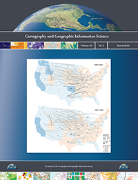
Koylu, C., Kasakoff, A. (2022). Measuring and mapping long-term changes in migration flows using population-scale family tree data. Cartography and Geographic Information Science, 46(1), 57-71. DOI: https://doi.org/10.1080/15230406.2021.2011419(Featured on the cover) |
Koylu, C., Tian, G., & Windsor, M. (2022). FlowMapper.org: A web-based framework for designing origin-destination flow maps. Journal of Maps. DOI: https://doi.org/10.1080/17445647.2021.1996479 |
|
Kwon, H., Hom, K., Rifkin, M., Tian B. & Koylu, C. (2021). Exploring the spatiotemporal heterogeneity in the relationship between human mobility and COVID-19 prevalence using dynamic time warping. GIScience 2021 Workshop on Advancing Movement Data Science (AMD’ 2021), September 27, 2021, World Wide Web. DOI: https://arxiv.org/abs/2109.13765 |
|
Koylu, C., Guo, D., Huang, Y., Kasakoff, A. B., & Grieve, J. (2020). Connecting family trees to construct a population-scale and longitudinal geo-social network for the U.S., International Journal of Geographical Information Science. DOI: https://doi.org/10.1080/13658816.2020.1821885 |
|
Koylu, C., & Kasakoff, A. (2020). Mapping Temporal Trends of Parent-Child Migration from Population-Scale Family Trees, AutoCarto 2020 - The 23rd International Research Symposium on Cartography and GIScience, November 18, 2020, World Wide Web. DOI: https://arxiv.org/abs/2012.11007 |
|
Zhang, B.* & Koylu, C. (2020). Identifying Vulnerabilities in Multilayer Spatial Networks: A Case Study of Food Flows in The United States, AutoCarto 2020 - The 23rd International Research Symposium on Cartography and GIScience, November 18, 2020, World Wide Web. |
|
Sit, M., Koylu, C. & Demir I. (2019). Identifying disaster related tweets and their semantic, spatial and temporal context using deep learning, natural language processing and spatial analysis: A case study of Hurricane Irma, International Journal of Digital Earth. DOI: https://doi.org/10.1080/17538947.2018.1563219 |
|
Koylu, C., Zhao, C. & Shao, W. (2019). Deep neural networks and kernel density estimation for detecting human activity patterns from geo-tagged images: A case study of birdwatching on Flickr, ISPRS International Journal of Geo-Information, 8(1), 45. DOI: https://doi.org/10.3390/ijgi8010045 |
|
Zhu, X., Guo, D., Koylu, C. & Chen, C. (2019). Density-Based Multi-scale Flow Mapping and Generalization, Computers, Environment and Urban Systems, 77, 101359. DOI: https://doi.org/10.1016/j.compenvurbsys.2019.101359 |
|
Xu, H., Demir, I. Koylu, C. & Muste, M. (2019). A web-based geovisual analytics platform for identifying potential contributors to culvert sedimentation, Science of the Total Environment, 692, 806-817, DOI: https://doi.org/10.1016/j.scitotenv.2019.07.157 |
|
 |
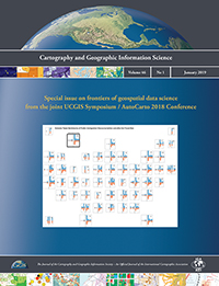
Koylu, C., Larson, R., Dietrich, B. & Lee, K.P. (2019). CarSenToGram: Geovisual text analytics for exploring spatio-temporal variation in public discourse on Twitter, Cartography and Geographic Information Science, 46:1, 57-71, DOI: https://doi.org/10.1080/15230406.2018.1510343 (Featured on the cover) |
Koylu, C. (2019) Modeling and visualizing semantic and spatio-temporal evolution of topics in interpersonal communication on Twitter, International Journal of Geographical Information Science, 33:4, 805-832, DOI: https://doi.org/10.1080/13658816.2018.1458987 |
|
Kasakoff, A. B., Koylu, C., Huang, Y., & Guo, D.(2019) “Changes in kin proximity in the 19th Century United States”, International Seminar on Kinship and Reproduction in Past Societies, August 22, 2019, Minneapolis. |
|
Koylu, C., Delil, S., Guo, D. & Celik, R.N. (2018) Analysis of Big Patient Mobility Data for Identifying Medical Regions, and Spatio-temporal Characteristics and Care Needs of Patients on the Move, International Journal of Health Geographics, 17(1), 32, DOI: https://doi.org/10.1186/s12942-018-0152-x |
|
Koylu, C. (2018). Uncovering geo-social semantics from the Twitter mention network: An integrated approach using spatial network smoothing and topic modeling, “Human Dynamics Research in Smart and Connected Communities”, Human Dynamics in Smart Cities. Springer, Cham. DOI: https://doi.org/10.1007/978-3-319-73247-3_9 |
|
Koylu, C. (2018). Discovering Multi-Scale Community Structures from the Interpersonal Communication Network on Twitter. In L. Perez, E.-K. Kim, & R. Sengupta (Eds.), Agent-Based Models and Complexity Science in the Age of Geospatial Big Data (GIScience 2016) (pp. 87-102). Cham: Springer International Publishing. DOI: https://doi.org/10.1007/978-3-319-65993-0_7 |
|
Koylu, C., Dietrich, B. & Larson, R. (2018). Geovisual text analytics for exploring public discourse on Twitter: A case study of immigration tweets before and after the January 27, 2017 Travel Ban, AutoCarto/UCGIS International Research Symposium, May 24, 2018 Madison, Wisconsin. |
|
 |
Koylu, C. & Guo, D. (2017). Design and evaluation of line symbolizations for origin–destination flow maps. Information Visualization, 16(4), 309-331. DOI:https://doi.org/10.1177/1473871616681375(Featured on the cover) |
Koylu, C. (2016). Extracting and Visualizing Geo-Social Semantics from the User Mention Network on Twitter. Proceedings of GIScience 2016 Workshop on Rethinking the ABCs: Agent-Based Models and Complexity Science in the age of Big Data, CyberGIS, and Sensor Networks, Montreal, Canada, September 27, 2016. |
|
Guo, D., Kasakoff, A. B., Koylu, C., Huang, Y., & Grieve, J. (2015) “Historical Population Informatics: Comparing Big Data of Family Trees and the U.S. 1880 Census for Migration Analysis”, Population Informatics for Big Data (PopInfo'15) in conjunction with the 21st ACM SIGKDD Conference on Knowledge Discovery and Data Mining (KDD), August 10, 2015, Sydney. |
|
 |
Koylu C.*, D. Guo, A. Kasakoff, and J. W. Adams (2014). "Mapping Family Connectedness across Space and Time",Cartography and Geographic Information Science, 41 (1), pages 14-26. DOI: https://doi.org/10.1080/15230406.2013.865303 (Featured on the cover) |
Koylu, C.* and D. Guo. (2013). "Smoothing Locational Measures in Spatial Networks", Computers, Environment and Urban Systems. Vol. 41, Pages 12-25. DOI: https://dx.doi.org/10.1016/j.compenvurbsys.2013.03.001 |
|
Koylu, C. Guo, D., and Kasakoff, A. “Mapping social relationships across space and time”, AutoCarto International Research Symposium, September 17, 2012 Columbus, Ohio. |